-40%
Gold mines near Barstow, Boron, Calif, Fremont Peak, Opal Mtn, BIG maps, RARE !
$ 40.53
- Description
- Size Guide
Description
First-edition report pinpoints goldmines near Barstow and Boron, CA
Report also describes and locates "one of the
largest" vertebrate fossil deposits in North America
Area is on federal land and is COMPLETELY open to prospecting and mineral
collecting — no guards, fences, barking dogs and no trespassing signs
—
T
his first-edition report locates a HUGE fossil deposit and gold mines in the Mojave Desert near Barstow and Boron, California.
Prospecting is allowed!
Fossil deposit is huge!
The area is almost entirely on federal land, which is open to the public. Mineral collecting and prospecting are allowed. All of these mines are completely accessible and completely deserted. You can go anywhere you want at these sites and pretty much do whatever you want, when you want, as long as it's legal. And you're only 90 minutes from Los Angeles!
The fossil deposits are some of the largest of their type in North America.
Mines, fossils and geology are all discussed in the text and pinpointed on FOUR large separate maps. Both the maps and 64-page report are in very good, near-fine condition.
Index map shows area of Mojave Desert covered by book. Other maps that come with this report are much, much more detailed and much larger than the map above.
No guards, fences, barking dogs, no-trespassing signs
There are no guards, fences, barking dogs or no trespassing signs. All these mines are miles away from any town of any size and are on federal Bureau of Land Management lands and are open to prospecting and mineral collecting.
We have many MANY more rare mining books! Just search for our ebay store, Rare Mining Books:
http://stores.ebay.com/Rare-Mining-Books?_rdc=1
Between Barstow and Johannesburg
Although the area covered by this book is remote, it is
easily
reached by paved and dirt roads. Several of these mining operations were sizable, leaving behind underground workings, dumps, tailing piles, artifacts, super photo opportunities and ACRES and ACRES of primo metal-detecting opportunities.
Not only do you have a chance of finding the world's largest gold nugget with a metal detector at these sites, but there were also a lot of people working here, dropping change, jewelry and other artifacts — items that are now sitting there waiting for you to pick them up.
Or if you like visiting places that used to be some place, this report is for you.
But in order to see these mines, you have to find them, and in order to find these mines, you need the directions and maps from this report.
Most roads are accessible by a standard auto
Most of these roads are completely accessible by a standard auto with highish ground clearance. This area is plainly marked on the Auto Club of Southern
California San Bernardino County road map, so the road map can be used easily to correlate exact mileages to mines and other geologic features on the maps from this book. (For more detailed information on this area's location, see the very end of this ad.)
Center of the area is 20 miles northwest of Barstow. The west side of the area is near Randsburg and Johannesburg. The area includes Harper Valley, Fremont Peak, Opal Mountain, Black Mountain, Williams Plain and the Mud Hills. ( To see just how much real estate this 1968 book covers, see the map above.)
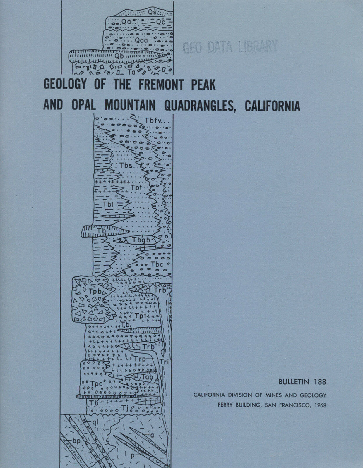
Geology of the Fremont Peak and Opal Mountain Quadrangles, California
(cover at right) — by noted California geologist T. W. Diblee Jr. — is not some gift-shop rockhound book; it was prepared by the California Division of Mines and Geology 35 years ago. It contains much valuable information for history buffs, bottle collectors, paleontologists, photographers, rockhounds, prospectors, hikers, offroaders, geologists — just about anyone interested in the Mojave Desert's geology and historic old mine sites.
Mines and prospects covered include:
Coolgardie Camp
, a gold area "literally honeycombed with diggings," according to the book.
Fremont Peak mine
; "gold pyrite and arsenopyrite occur in veins and also along the contact between the quartz monzonite and rhyolitic dikes."
Six lode claims
near Fremont Peak.
Shallow shafts
in another unnamed deposit near Fremont Peak.
The Hamburger Mill
.
The Ross strontianite deposit
.
Perlite outcroppings
near Opal Camp.
Agate nodules
near Opal Mountain.
Colored jasper
and more.
You can't look for "color" in mine dumps or for fossils if you don't know the locations of the most-productive gold mines and most-likely fossil areas. Don't waste weekends randomly digging through barren tailing piles for specimens. This book and maps have exact locations. Just plug 'em into your GPS or look 'em up on the appropriate topo, and you're there!
Tiny detail of large color map from pocket: "Geologic and economic map of Fremont Peak and Opal Mountain 15-minute quadrangles, San Bernardino County, California." Note locations of gold prospects, one near lower center of map, another in upper left corner.
Don't rely on second-hand information
Okay, so you have a book by a "noted rockhound" or an "ace prospector." You might get lucky and find a couple of neat places, but you'll also hit plenty of absolute duds. Why? Because what rockhound, mine explorer or prospector in their right mind would give away their favorite productive locations? Not one. What they will give you are
directions to sites that are picked clean or second rate at best. Don't rely on secondhand information when you can get firsthand info from this book.
Want to prospect or collect at virgin, undiscovered locations instead of ones already known? Then you'll need to find new areas with geologic attributes conducive to containing the minerals or fossils that you're seeking. This book and map has that too (see map above). It was written about geology for geologists by geologists. Who knows, maybe you'll discover the next Lost Burro gold mine.
Recovered materials and from this area include:
Gold, strontianite, radioactive minerals, limestone, feldspar, quartz, perlite, pumicite, agate nodules, jasper, saline deposits and borates.
Fossils, fossils and more fossils
This area was not always the desert that it is today. Fossil remains indicate that large herds of animals once grazed on plains covered by luxuriant grasses.
"The large numbers of the grazing animals — such as horses, camels and antilocaprids — and the variety of carnivores ... are strongly reminiscent of the present fauna of the African savannas, with grassy plains and scrub forest."
"The fossil vertebrate fauna from the Barstow formation exposed in the Mud Hills is one of the largest found in the Cenozoic rocks of the North America, and has been studied by many vertebrate paleontologists ... The most common fossils of the
Another tiny detail of color map from pocket showing more gold prospects. Name of well has been blurred intentionally to protect mine locations. Name of well on real map is not blurred.
Barstow formation are bones and teeth of the species
Merychippus intermontanus
, a small three-toed horse. Also abundant are bones and horns of the antelope
Merycodus
and the bones of camels ... The Barstow Formation yielded remains of seven mammalian species from four species from four localities northwest of Black Canyon. Three of these localities are located on the (included) geologic map of the quadrangle."
Large maps folded in pocket
Like other sought-after mining and geology books about the Mojave Desert, the oversize folded maps are arguably the real prize here. They would look
great
framed if they weren't so useful in the field. Then again, you could have the best of both worlds: Make copies of them for the field, and frame the originals. The first one in the list below is a particularly handsome example of geologic cartography with pleasing colors and nicely executed calligraphy; they just don't make 'em like this any more.
Book describes geology in detail
Because this is, after all, a book about mining
and
geology, it covers the latter topic in minute detail. The rocks of the two mapped quadrangles may be grouped into three main divisions generally present in the western Mojave Desert: granitic and metamorphic rocks of pre-Tertiary age; nonmarine volcanic, pyroclastic and sedimentary rocks of Tertiary age; alluvial sediments; and a basalt flow of Quaternary age.
Of course, the text contains far, far more detail about geology — especially how it relates to mineral deposits and their formations — than just the previous paragraph. Geology varies widely over an area the size of these two quadrangles, so it is impossible to convey but the simplest geologic features in an ad.
Maps in the rear pocket:
"Geologic and economic map of Fremont Peak and Opal Mountain 15-minute quadrangles, San Bernardino County, California;" color,
very
nice map.
"Structure sections of the Fremont Peak and Opal Mountain 15-minute
quadrangles, San Bernardino County, California;" color.
"Geologic Map of the Mud Hills, San Bernardino, California;" black and white.
"Generalized geologic map of the Mojave Desert region, California, showing
geologic setting of Fremont Peak and Opal Mountain quadrangles;" black and white.
The book:
Geology of the Fremont Peak and Opal Mountain Quadrangles, California
, Bulletin 188, first edition, 1968, by T. W. Diblee Jr., California Division of Mines and Geology, San Francisco, CA, 64 pages, 8.5 by 11 inches. Stapled binding. In near-new fine condition; four maps in pocket (two in color) are folded with some slight rippling, otherwise in very good shape. Light stamp on cover and a couple stamps in the interior pages.
Payment methods and domestic shipping
Paypal only. FREE domsetic shipping and handling via priority mail. I pride myself on bulletproof packaging and ship in sturdy cardboard boxes or heavily reinforced padded envelopes.
The fine print:
Feel free to contact me if you have any questions about the item or terms of sale.
I post feedback once a week. Not responsible for typographical errors.
Good luck and thanks for bidding!
Small detail of of another full-color map from pocket, "Structure sections of the Fremont Peak and Opal Mountain 15-minute quadrangles, San Bernardino County, California." Map shows how faulting and intrusion has exposed what rock types and where, invaluable in determining likely places to look for minerals, ores and precious metals.
Where is it?
Center of the area covered is 20 miles northwest of Barstow or six miles south of the southwest corner of Opal Mountain quadrangle. The railroad siding of Hinkley is four miles south of Opal Mountain quadrangle and 11 miles west of Barstow. At the time of the report, the only settlement within the mapped area was Lockhart Ranch, in Harper Valley, in the southeastern portion of the Fremont Peak quadrangle. Coolgardie Camp, deserted since 1940, is in the low hills east of Harper Valley.
The mapped area is easily accessible by many roads. Route 58 passes a few miles south of the mapped area; it runs between Barstow and Boron. U.S. Highway 395 passes a few miles west of Fremont Peak quadrangle, between Adelanto and Johannesburg (and neighboring Randsburg). Following 395 further north leads to Inyokern in Inyo County. Turning right on 178 before Inyokern would take you north through Ridgecrest, Trona and Panamint Valley, now part of Death Valley National Park.
Counties adjacent to San Bernardino are Riverside, Orange, Los Angeles, Kern and Inyo. Nearby counties include Imperial, San Diego, Ventura, Santa Barbara, San Luis Obispo, Kings, Tulare and Mono. San Bernardino County cities and towns include: Adelanto, Alta Loma, Apple Valley, Barstow, Big Bear Lake, Bloomington, Chino, Cima, Colton, Cucamonga, Essex, Etiwanda, Fontana, Forest Falls, George Air Force Base, Grand Terrace, Havasu Landing, Helendale, Hesperia, Highland, Hinkley, Lake Arrowhead, Loma Linda, Lucerne Valley, Mentone, Montclair, Morongo Valley, Mountain Pass, Mt. Baldy, Needles, Ontario, Oro Grande, Parker Dam, Phelan, Pinon Hills, Pomona, Rancho Cucamonga, Redlands, Rialto, Upland, Yermo, and Yucca Valley.
Track Page Views With
Auctiva's FREE Counter
